01 · Mangroves
Tide-aware mangrove mapping
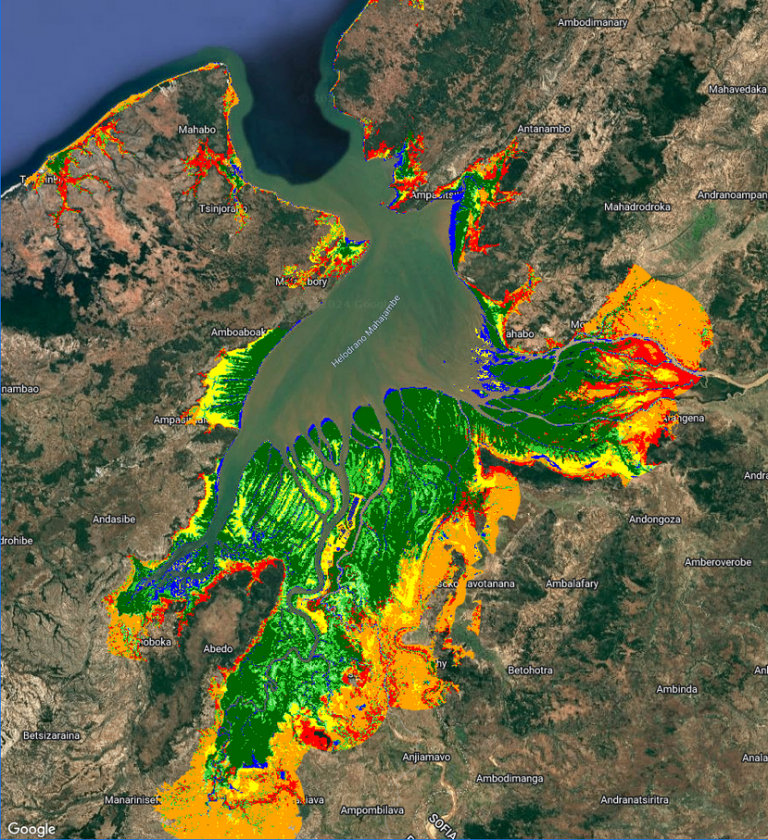
Mahajamba Bay, Madagascar · 15.5° S 47.1° E
Mangroves look completely different at high and low tide, so global maps miss them. GEM maps them from Sentinel-2 imagery taken at consistent tides, as a desktop tool and an Android app built with Blue Ventures.
Read about GEM